A day in the software life of an Antarctic Marine Biogeographer
A day in the software life of an Antarctic Marine Biogeographer
 By Huw Griffiths, British Antarctic Survey.
This article is part of our series: a day in the software life. In this series, we will be asking researchers from all disciplines to discuss the tools that make their research possible.
Biogeography is the study and explanation of distribution patterns of living organisms. Studying the patterns of animals that live on the seafloor around Antarctica requires a range of techniques and methods, all of which require specialist software.
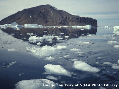
For me, a typical day is completely dependent on the season. During the Antarctic Winter, which takes place at the same time as the UK summer, I am based in Cambridge working from my office. However, during the Antarctic Summer, or UK Winter, I can be found dodging icebergs on a research ship in the Southern Ocean.
Both elements of my job involve shared software elements. Excluding obligatory packages such as Microsoft Office, my day to day use of software is centred around Geographic Information Systems (GIS). My GIS of choice is ArcGIS by Esri.
On the ship I use the GIS to plot and map potential fishing sites using data collected by the ship’s seafloor mapping system. These maps are analysed to determine the most suitable place to use our nets and video cameras and to calculate the water depth and distance between samples.
Back at the office, I plot samples to produce detailed location maps. I then analyse these data points using a combination of the GIS, databases and multivariate statistical software (PRIMER 6) to discover the trends and patterns in the animals caught. Such systems can analyse huge numbers of records. We have used them to analyse biogeographic patterns for all digitised species records from the Southern Ocean, dating back over two hundred years to the earliest Antarctic expeditions.
Our software enables us to process and interpret more information than ever before, giving us a greater understanding of how life thrives deep beneath the Antarctic sea ice. Our data is then made publically available through regional nodes of the online biogeographic data portals OBIS (the Ocean Biogeographic Information System) and GBIF (the Global Biodiversity Information Facility). As a result, the Antarctic scientific community now has over 1.2 million records representing close to 10,000 species from the Southern Ocean (with new ones being discovered and added all the time).
This wealth of data brings me back to my latest office-based work - editing and producing maps using GIS for the new Biogeographic Atlas of the Southern Ocean. This massive undertaking will culminate in a printed and online Atlas that will combine these maps with detailed scientific information for all groups of marine animals from Antarctic waters.